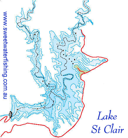
Situated
25 km north of Singleton in the foothills of the Barrington
Tops National Park, Lake St Clair provides an expanse
of water 15 kilometres long and up to 3 kilometres wide.
It has a storage capacity of 283,000 million litres. About
half the volume of Sydney Harbour.
The dam wall is 67 metres high. When full, the lake has
a surface area of 1620 ha.
Glennies
Creek Dam is a curved earth and rockfill embankment with
a concrete slab on the upstream face to prevent water
from seeping through.
A 60 metre high control tower with variable level inlets
allows the quality and temperature of water released from
the dam to be selected.
This protects the animal and plant life within the river
downstream of the dam by ensuring that the water released
is similar to the water they would inhabit naturally.
The Gelnnies Creek Dam / Lake St Clair is appoximately
40 km upstream from the junction of Glennies Creek and
the Hunter River.
Fishing
Stocked fish: Australian Bass, Golden Perch, Silver Perch.
Other: Eels, Eel-Tailed Catfish & Carp
Facilities
The recreation area has electric BBQ, hot water, showers
and toilet facilities. Camping is permitted at the Lake.
Fees apply.
Other accommodation is available nearby, see Accommodation
page for details.
Boating
All forms of boating are permitted on Lake St. Clair.
There is a boat ramp at the camping area. An exclusion
zone exists near the dam wall.
Fishing
Fish present in lake: Australian Bass, Golden Perch, Silver
Perch, Eels, Eel-Tailed Catfish and carp.
Bass, Golden Perch and Silver Perch are stocked by the
Hawkesbury Nepean Bass Anglers Assn & the Singleton
Flyfishing Club using funds from Recreation Fishing Trusts.